Keynotes
Title: To be defined
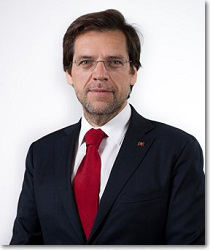
Miguel Castro Neto
 Biography
Miguel Castro Neto is Secretary of State of Spatial Planning And Nature Conservation.
Abstract
tbd.
Big Data Integration to Enable Citizen Participation in Smart Cities
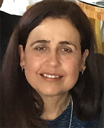
Isabel F. Cruz
 Biography
Isabel F. Cruz is a Professor of Computer Science in the College of Engineering at the University of Illinois at Chicago (UIC). She holds a PhD degree in Computer Science from the University of Toronto. She has received numerous awards for teaching, service, and research including the NSF Career Award and recently the University of Illinois Faculty Scholar Award (2012-2015), a Great Cities Institute Faculty Scholar (2014-2015), and a recipient of a UIC Civic Engagement Research Fund Award (2013-2014). She has more than 110 refereed publications in databases, geographic information systems, semantic web, visual languages, graph drawing, user interfaces, multimedia, information retrieval, and security. The broader impact of her research has been demonstrated in several real-world scenarios, including biomedical and geospatial interdisciplinary applications, and in teaching innovations. The AgreementMaker system has been one of the world leading ontology matching systems since 2009.
Isabel Cruz has been general chair, program committee chair or program committee vice/associate chair of several of the most important conferences in her fields of expertise, such as IEEE ICDE, ACM SIGSPATIAL GIS, International Conference on GeoSpatial Semantics, ACM Multimedia, ISWC, and ESWC and served on the program committees of more than 170 conferences. She has been editor to several books and journals and has participated in strategic planning committees including the Mapping Science Committee of the National Academies and in numerous NSF workshops, which she has chaired several times.
Cruz directs the Advances in Data, Visualization, and Information Science (ADVIS) Lab, which has been continuously funded by NSF since 1996, has graduated twenty students in their PhD and MS theses, and has published with fifteen of her undergraduate research advisees. Her leadership roles at UIC include being the Head Facilitator for the NSF Advance WISEST program (to increase the number, participation and leadership status of women in academic science and engineering). Other leadership roles at UIC include being chair of the CS faculty search committee, member of the dean of engineering search committee twice, member of the College of Engineering executive committee (since 2011), and member of the Provost's Sustainability Strategic Thinking Advisory Committee (SSTAC) since its inception (Fall 2012).
Abstract
To enable citizen participation in their city's life and governance we are developing a framework to establish interconnections among big data and allow the public to access those interconnections on an interactive web visualization platform, called GIVA (for Geospatial and temporal data Integration, Visualization, and Analytics). Using this framework, users can select regions in a map, specify time intervals, and select datasets to produce reports where values pertaining to different datasets are compared, analyzed, and visualized. The ultimate goal is for policy evaluation to be at everybody's fingertips. For example, citizens would be able to analyze the consequences of the planned closing of 50 Chicago public schools once data become available (in multiple data formats and resolutions) for those school districts. Relevant data may include education outcomes, crime statistics, property values, economic activity, and income distribution. Data are available from a variety of web sources in the form of tables. Therefore, an important component of GIVA is the ability to extract automatically data from tables. In fact, there are millions of web tables with geographic (and temporal) data that are pertinent not only to policy studies, but also to many other domains, such as urban sustainability, transportation networks, and public health. These tables are highly heterogeneous in structure, concepts, and metadata. One of the challenges in semantically extracting data from tables is the resolution of heterogeneities so as to uncover a conceptual hierarchy, metadata associated with the instances, and cell values, including geolocations. Once these important steps are achieved, big data integration can become a reality.
GIS and the Web – what's the problem?
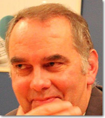
Phil Archer
 Biography
Phil Archer joined the W3C staff in February 2009 after many years representing one of its member organisations. He has lead or participated in working groups around the mobile Web and data, including the Semantic Web. In December 2013 he became Data Activity Lead, coordinating W3C's work in the Semantic Web, Linked Data and related technologies.
As well as work at the W3C, his career has encompassed broadcasting, teaching, linked data publishing, copy writing, and, perhaps incongruously, countryside conservation. The common thread throughout has been a knack for communication, particularly communicating complex technical ideas to a more general audience.
Abstract
The standards that underpin geospatial data all use Web technologies, notably XML which first became a W3C standard on 10 February 1998. So how come integrating geospatial data with other data on the Web is so hard and often requires manual intervention? Web applications often need to access small parts of multiple large datasets, search engines need to match unstructured text on the Web with locations, data publishers have a lot of choice in how they share their data but which of the many available standards is best for a given context? These problems and more arise at least in part from the difference in culture between the geospatial world in which the primary reference is to a point, line or polygon, and the Web where the primary reference is the identifier, the URI, of a document, a concept, a building or a data point - one property of which might be a location.
A workshop on this topic organised by the EU's SmartOpenData project in March 2014 lead directly to a collaborative effort between the two key standards bodies: the World Wide Web Consortium (W3C) and the Open Geospatial Consortium (OGC). W3C's Data Activity Lead, Phil Archer, will reflect on the problems that have been identified and what needs to be done if the two ecosystems are to benefit from each other's data.
